GNSS signals
Multi-constellation signals illuminate the water surface.
Land-based · Non-contact · Remote
AquaScope uses reflections from GPS, BeiDou and Galileo signals to measure water level from land—supporting coastal, river, reservoir and temporary monitoring without placing sensors in the water.
A more deployable network
AquaScope Technology Limited is a Hong Kong marine and hydrological monitoring company developing GNSS-reflection instruments and cloud management systems for authorities, infrastructure operators, engineering teams and environmental organisations.
Conventional stations can be costly and slow to build.
Water depth, waves and geology restrict suitable sites.
In-water equipment demands ongoing field maintenance.
Remote and temporary missions need faster deployment.
One connected system
Hardware, edge processing, communications and cloud tools work together as one remote monitoring chain.
Multi-constellation signals illuminate the water surface.
Direct and reflected paths form measurable interference patterns.
An antenna and receiver observe the signal without touching water.
On-site algorithms derive results and retain data during outages.
Sites, history, health, alerts and APIs in one remote view.
Products & services
01 / Hardware
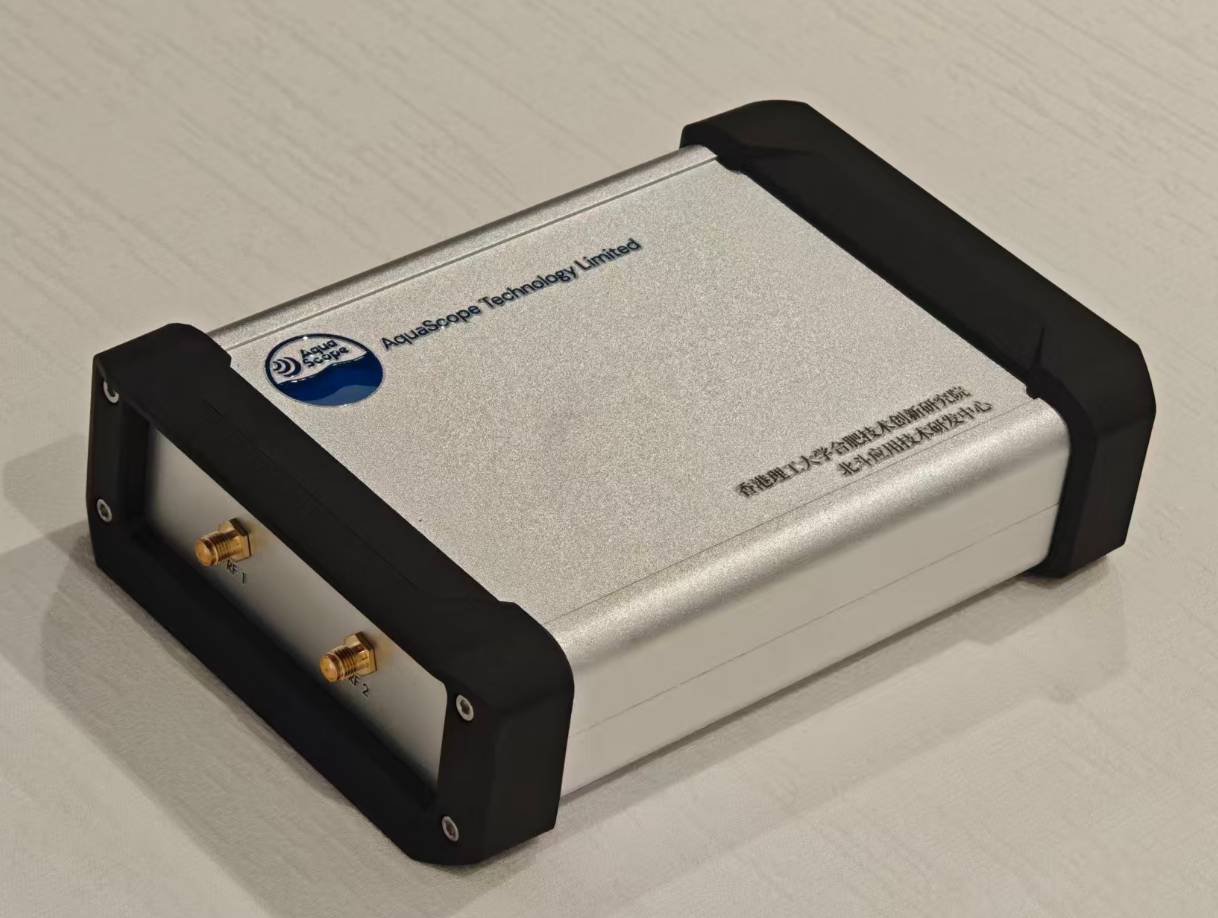
A complete independent station combining antenna, Gen 1.0 receiver, edge processing, connectivity and power.
02 / Retrofit
Add water-level capability to suitable existing GNSS or CORS infrastructure while retaining its positioning role.
03 / Platform
Real-time and historical water data, station health, remote configuration, downloads, alerts and API access.
04 / Expertise
Site assessment, installation design, pilot deployment, data validation, custom development and system integration.
Technology
As satellites move across the sky, direct and water-reflected signals form changing interference patterns. AquaScope processes those observations at the station to derive water-level results.
Designed for GPS, BeiDou and Galileo observations.
Interference features, multi-frequency observations and tidal behaviour are processed together.
Local computation reduces transfer needs; buffered data resumes after network recovery.
Applications
For marine authorities, ports, coastal engineering, surveying and research.
For water authorities, reservoir operators and hydraulic engineering teams.
Supplementary observations during extreme weather, works or station maintenance.
Extend suitable CORS sites, towers and coastal infrastructure with water sensing.
Centralised multi-site management, alerts and API integration.
Field evidence
Results below distinguish post-processed and real-time outcomes. Performance depends on site geometry, configuration and environmental conditions.
RMSE
RMSE
RMSE · updates under 1 minute
Sea-level monitoring validation
Elevated coastal installation
Coastal demonstration system
River water-level monitoring
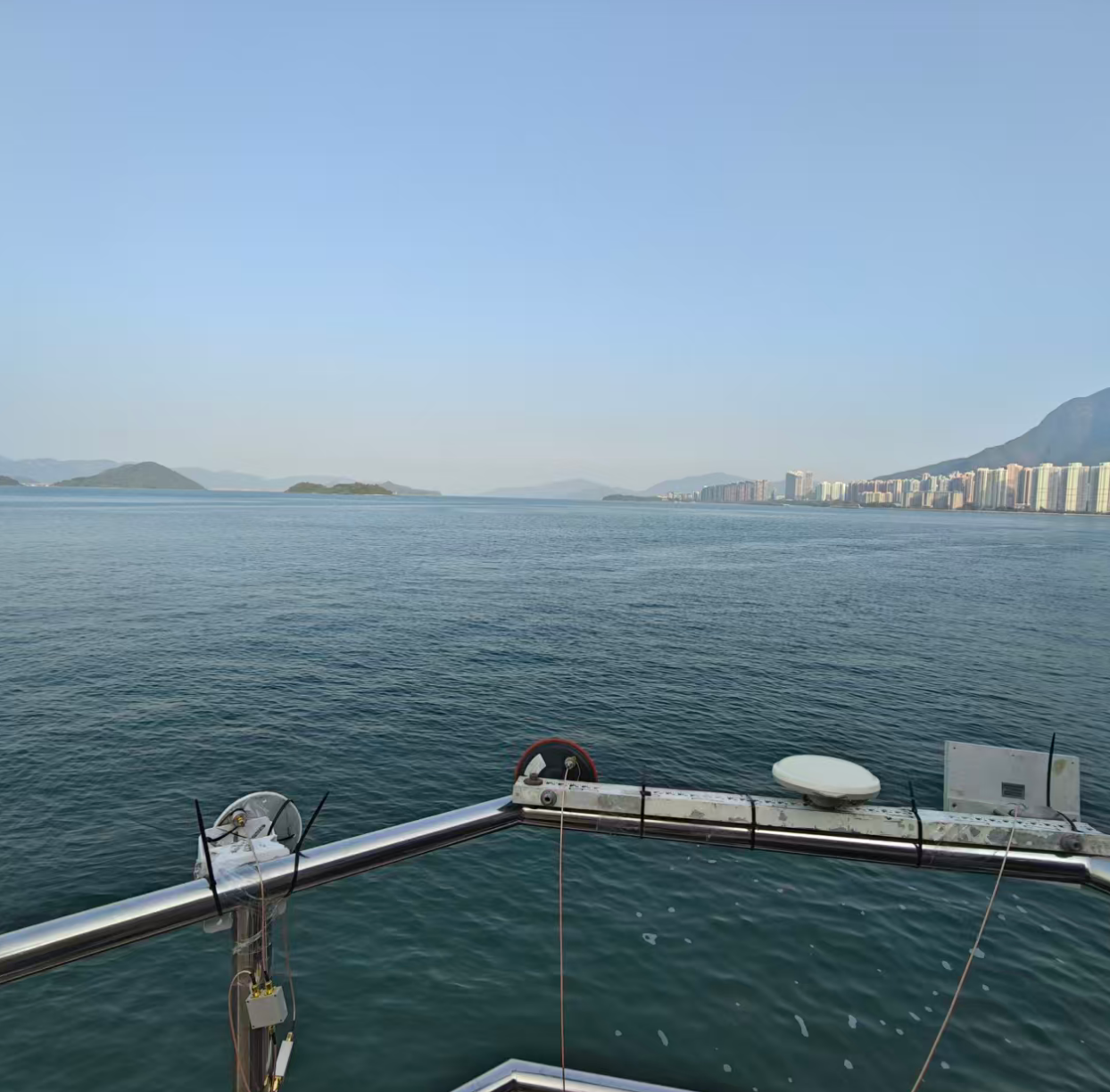
A coastal field setup used during receiver and antenna development.
About AquaScope
Founded in Hong Kong in 2024, AquaScope focuses on GNSS reflection remote sensing, water-level monitoring and the tools needed to operate distributed stations.
Make reliable water-level monitoring easier to deploy where conventional stations are costly or difficult to build.
Start with the site
For a useful first discussion, prepare the location, mounting height, water-surface visibility, available power and communications, desired update interval and any reference instrument.